
Agriculture is entering a data-driven era. At the University of Saskatchewan, researchers are combining satellite imagery, artificial intelligence, and on-the-ground farm data to fundamentally change how crops are grown, managed and sustained, with the goal of growing food more efficiently and sustainably for Canadians.
Why digital agriculture matters for everyday Canadians
Digital agriculture may sound abstract, but it has very practical goals:
- Helping farmers use fertilizer, seed and crop protection products more precisely, so they can grow more with less.
- Identifying problem spots in fields so inputs are not wasted on land that is unlikely to produce a good crop.
- Better understanding how weather, soil and topography affect crops, which supports more stable harvests and reliable food supplies.
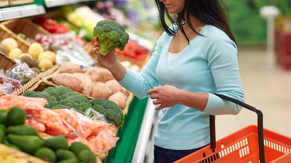
- For grocery decision-makers, this kind of innovation supports a more sustainable, efficient food system over time. It opens up new possibilities for how and where crops are grown in Canada.

College of Agriculture and Bioresources, University of Saskatchewan
New digital research centre
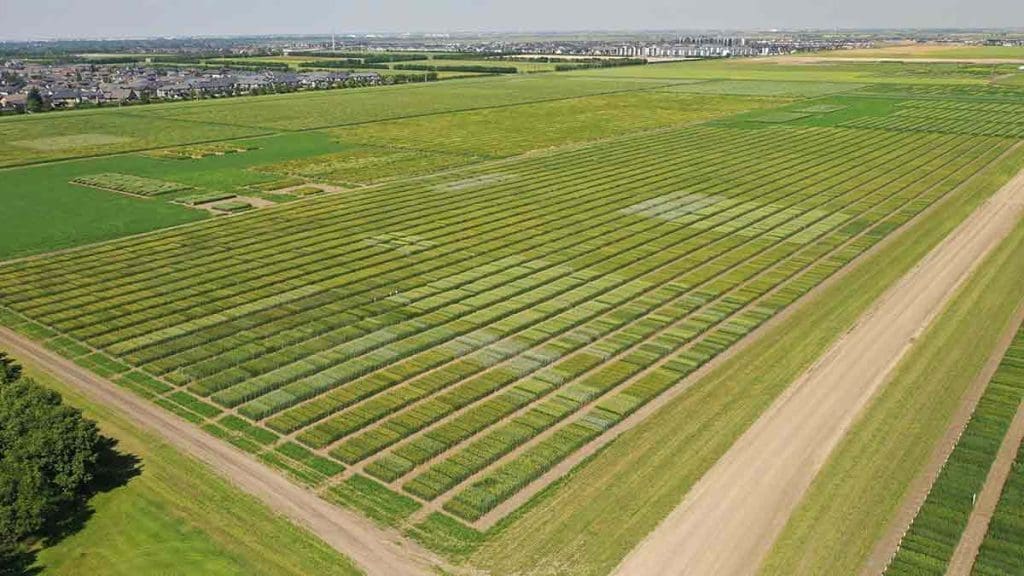
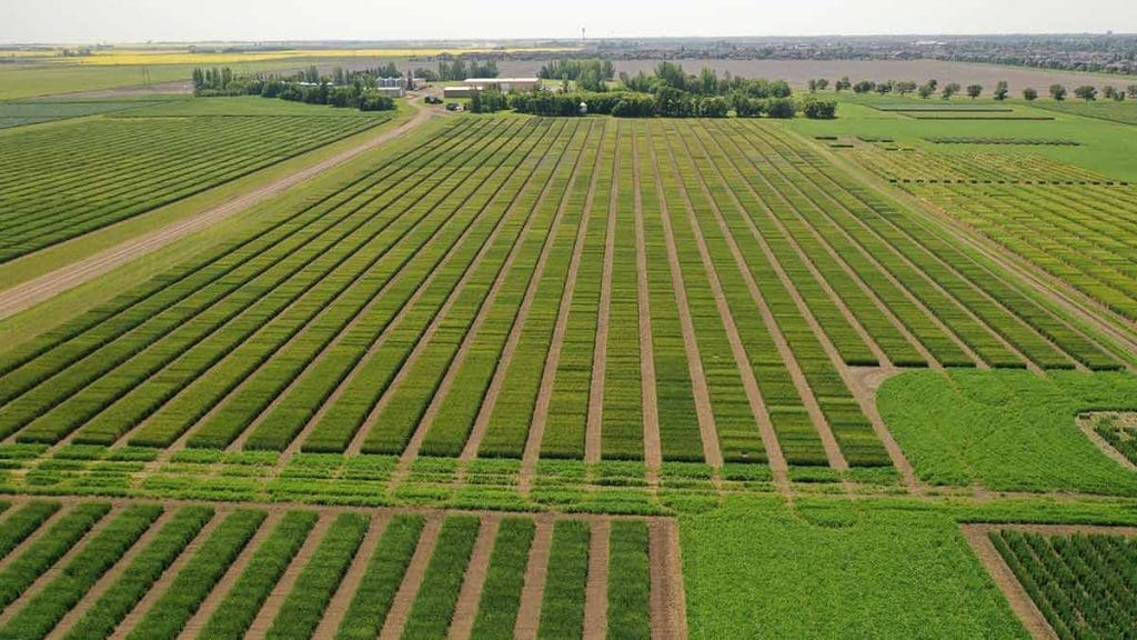
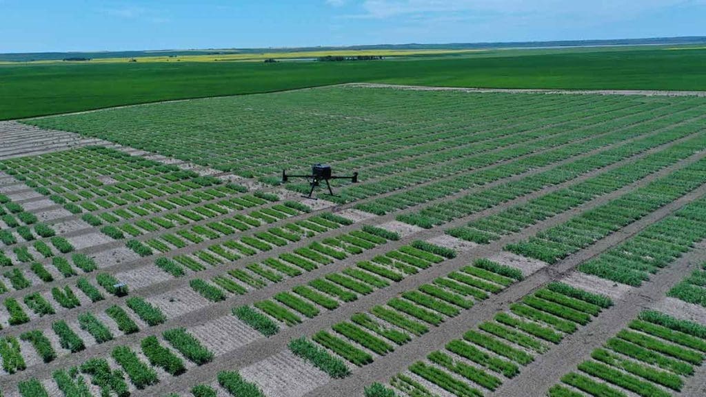
Dr. Steve Shirtliffe is a professor of crop agronomy at the University of Saskatchewan and the director of the Nutrien Digital Agriculture Center. It’s a research hub designed to accelerate farming even further into the digital age while improving environmental and economic outcomes.
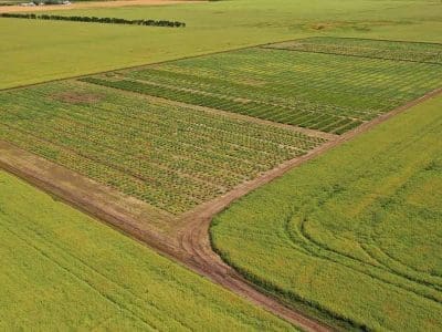
These researchers use phenometrics, which is the use of aerial images to measure plant characteristics such as growth rate, development timing, and yield potential. In simple terms, it means using pictures from drones or satellites to see how well crops grow over time. Shirtliffe and his team began using drones to collect this data from various fields in Saskatchewan with the goal of helping plant breeders select better-performing crop varieties.
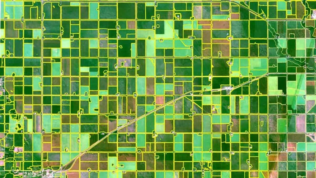
Once tools like Google Earth Engine became available, it allowed for the analysis of millions of acres rather than field by field. Now satellite and geospatial data can also integrate crop imagery over time, weather patterns, and soil and topographic data.
Mapping variability within fields
As farmers have always known, farmland is not uniform, even within a single field. Hilltops may produce lower yields, low-lying areas next to wetlands are sometimes saline (high salt, which is poor for growing) and some zones consistently underperform.
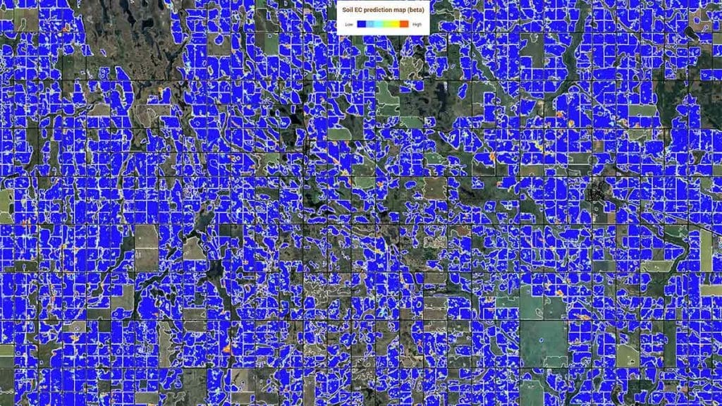
Using machine learning models trained on farmer-provided yield data, researchers at the University of Saskatchewan were able to predict crop yields and map productivity to a 10-metre resolution across thousands of acres. This kind of analysis is the basis of precision agriculture, where inputs such as fertilizer or seed are tailored to specific zones within a field. That means the model can show which parts of a field are strong performers and which parts struggle, almost like a detailed health check for each zone in the field. For farmers, that helps reduce waste and focus resources where they do the most good. For consumers, it supports more efficient production of the crops that ultimately become the foods in Canadian grocery stores.
The emergence of large-scale agricultural AI
The University of Saskatchewan team led by Shirtliffe have developed the Geospatial Agroecosystem Inference Engine (GAIG), a tool that can predict yields, map weeds and identify marginal land: all capabilities that allow decisions toward a more sustainable future.
In practice, GAIG takes data from satellites, weather records and farm fields and turns it into maps and predictions that farmers and researchers can use to make better decisions about where and how to grow crops.
“We’re trying to find answers to some of the biggest questions of our society,” Shirtliffe explains, “like how can we produce more food with less land? Where in fields do greenhouse gases get emitted? What drives the biodiversity of soils? How can we increase the efficiency of fertilizer and other inputs?”
Practical applications for farmers
The research is intended to solve real-world problems, such as:
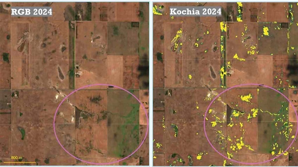
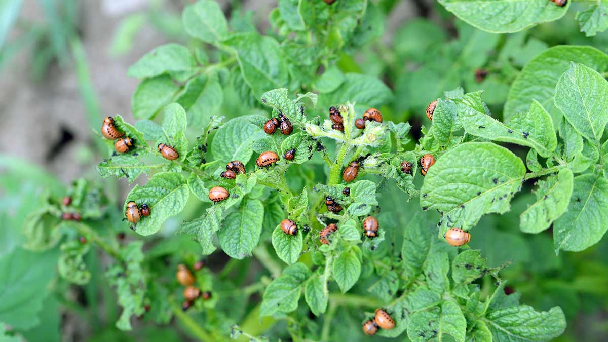
1. Weed detection at scale
- AI models trained on drone images can detect weeds (e.g., herbicide-resistant kochia) via satellite imagery
- Farmers can target control measures before weeds spread
2. Identifying unproductive land
- Persistent low-yield zones (“marginal land”) can be mapped so that farmers can reduce inputs or convert land to perennial cover
3. Precision input management
- Fertilizer and crop decisions can be optimized by zone, which improves both environmental outcomes and farmer profitability
4. Environmental insights
- where greenhouse gases are emitted within fields
- what drives soil biodiversity
- how to improve soil fertility
Addressing societal issues while still helping farmers
Being able to consolidate and analyze all this information provides some incredible capabilities, but Shirtliffe points out they must be matched by ethical frameworks that protect the farmers whose data makes it possible.
When companies produce a new product, they can protect the innovations they come up with inside their businesses. For farmers, their innovations are out on the fields that they grow their crops on. There are no roofs; anyone can see the satellite images. However, without the yield maps and the models that were used to understand them, it’s difficult to predict yields.
“For the security of our farmers, we can’t give everything away, not all of our predictions,” says Shirtliffe. “We have to think of our cooperators, the farmers and their livelihoods. Our challenge is to make this information available to farmers so they can benefit from it, but not be exploited.”
The solution is to create models that can help farmers. “We don’t want to lose sight of that,” Shirtliffe says. “We will not sell or give away the detailed yield predictions. Farmers are sharing yield data with us, and we still very much need that information and the support of our farmers to get this work done. I think we can use this data to do good while still protecting farmer sensitivities and not upsetting the markets, land values, crop commodity prices, or even national security interests.”
The Centre’s guiding principle is that data and tools must benefit farmers directly, so sensitive data is not publicly released and models are designed for decision support, not external exploitation.
Data analysis is redefining how farming operates
The integration of satellite imagery, AI, and farm-level data is redefining how agriculture operates in Western Canada. What began with a few drones capturing crop images has evolved into a system capable of analyzing millions of acres and offering insights into productivity, sustainability, and environmental impact at unprecedented resolution.
For Canadians, this work is an example of how innovation in agriculture is quietly solving big challenges: using inputs more efficiently, improving understanding of environmental impacts, and helping keep food production resilient in a changing climate.
At the same time, the success of digital agriculture will depend not only on better models, but on maintaining trust between researchers and producers—ensuring that innovation remains grounded in practical benefit.
Sources
- Tedx Talk: “I Know What You Grew Last Summer,” by Dr. Steve Shirtliffe, 2025, https://www.youtube.com/watch?v=hioZNUbzGUQ
- Nutrien Centre for Sustainable and Digital Agriculture: https://agbio.usask.ca/research/centres-and-facilities/nutrien-centre-for-sustainable-and-digital-agriculture.php
More Stories About Innovations in Agriculture


 How Do Seeders and Air Drills Work?
